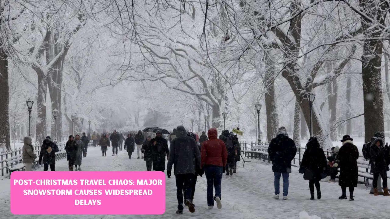
The serene conclusion of the Christmas holiday has been abruptly replaced by a logistical nightmare for millions of travelers across the United States. As families packed their bags to return home on Friday, December 26, 2025, a potent winter storm intensified over the Northeast and Midwest, turning major highways into skating rinks and grounding hundreds of flights.2 This atmospheric system, which began building momentum just as the last of the gift wrap was being cleared, has created a “perfect storm” of high travel volume and hazardous meteorological conditions.
The Impact on Air Travel and Major Hubs
Aviation has borne the brunt of the storm’s initial fury. Major transit points, including New York’s John F. Kennedy International, LaGuardia, and Newark Liberty, reported a combined total of over 400 cancellations by midday Friday.4 Ground stops were frequently implemented as visibility dropped below safe operating minimums. For those lucky enough to have their flights remain on the board, delays averaged two to three hours as ground crews struggled with de-icing operations and runway clearing. The congestion has rippled across the country, affecting connecting flights as far west as Chicago and Denver, proving that a localized storm can easily trigger a national domino effect in the airline industry.
Treacherous Road Conditions for Millions
While the skies are chaotic, the situation on the ground is arguably more dangerous. AAA had previously projected a record-breaking 122.4 million Americans would be traveling this holiday season, with nearly 90% choosing to drive.6 The timing of this storm, hitting squarely on the Friday afternoon commute, has trapped many motorists in slow-moving traffic amidst falling snow and sleet.7 Interstate corridors, particularly I-95 in the Northeast and I-80 through the Midwest, have seen a spike in minor collisions and spin-outs. State police departments have issued urgent advisories, urging people to stay off the roads unless travel is absolutely necessary, as plunging temperatures make snowmelt refreeze into invisible black ice.
Regional Snowfall and Weather Data
The storm’s footprint is vast, stretching from the Great Lakes down to the Mid-Atlantic. While some areas are seeing a “wintry mix” of rain and sleet, the heart of the storm is delivering heavy, wet snow that is difficult to plow and poses a risk to power lines.9 Forecasters have noted that this system is particularly fast-moving, which, while limiting total accumulation in some spots, increases the intensity of the snowfall during the peak evening hours.
| Region / City | Expected Snowfall | Primary Impact |
| New York City & Tri-State | 4 – 8 Inches | Major flight cancellations & road delays |
| Lehigh Valley / Poconos | 6 – 10 Inches | Hazardous mountain driving & ice buildup |
| Philadelphia Metro | 1 – 3 Inches | Sleet and freezing rain; slippery commutes |
| Southern New England | 3 – 6 Inches | Visibility issues and school/office closures |
| Western Pennsylvania | 2 – 5 Inches | Significant risk of freezing rain and power outages |
The Struggle for Public Transit and Rail
It isn’t just cars and planes facing the squeeze; rail and bus services are also feeling the pressure.11 Amtrak has reported modified schedules along the Northeast Corridor to account for the weather, with some regional lines experiencing significant delays.12 Commuter rails in New York and Philadelphia have faced equipment issues due to the freezing temperatures, leading to overcrowding on platforms as passengers wait for delayed trains.13 For those relying on bus travel, the story is much the same, with many intercity carriers opting to suspend service until the primary snow bands pass and plows can clear the secondary roads.
Emergency Response and Safety Measures
In response to the escalating crisis, governors across several states have activated emergency operation centers. Salt trucks and plows have been deployed in full force, yet the sheer volume of precipitation is making it difficult to maintain clear lanes. Emergency services have reminded travelers to carry a “winter survival kit” in their vehicles, including blankets, flashlights, and non-perishable snacks.14 The risk of power outages remains a concern, particularly in areas like Western Pennsylvania where freezing rain is expected to coat trees and utility lines in a heavy layer of ice.
Navigating the Aftermath and Looking Ahead
As the storm is expected to move offshore by Saturday afternoon, the focus will shift from survival to recovery. However, the backlog of travelers means that the “travel chaos” will likely linger through the remainder of the weekend.16 Airlines are working to rebook displaced passengers, but with many flights already at capacity for the New Year’s holiday, finding open seats is a challenge. Travelers are encouraged to use mobile apps to monitor their flight status in real-time and to allow for triple the usual travel time if they must venture out onto the roads.
Expert Tips for Stranded Travelers
For those currently caught in the delays, patience is the only real remedy. Travel experts suggest that if your flight is canceled, calling the airline’s international service line or using social media can sometimes result in faster rebooking than standing in a long physical queue at the airport. Additionally, checking into a nearby hotel early—before they reach capacity—can be a wise move if it becomes clear that departures won’t resume until the following day. Safety should always take priority over the desire to get home quickly.

FAQs
1. Which airports are currently seeing the most cancellations?
The most significant disruptions are occurring at New York’s JFK, LaGuardia, and Newark Liberty airports.18 Philadelphia International and Boston Logan are also reporting an increasing number of delays as the storm moves North.
2. Is it safe to drive on the Interstates right now?
Authorities strongly advise against non-essential travel in the Northeast and parts of the Midwest.19 If you must drive, ensure your vehicle is equipped for winter conditions and stay tuned to local Department of Transportation updates for road closures.
3. When is the weather expected to clear up?
The bulk of the heavy snowfall is projected to taper off by midday Saturday, December 27. However, icy conditions and lingering travel backlogs are expected to persist throughout the weekend.
disclaimer
The content is intended for informational purposes only. you can check the officially sources our aim is to provide accurate information to all users.